


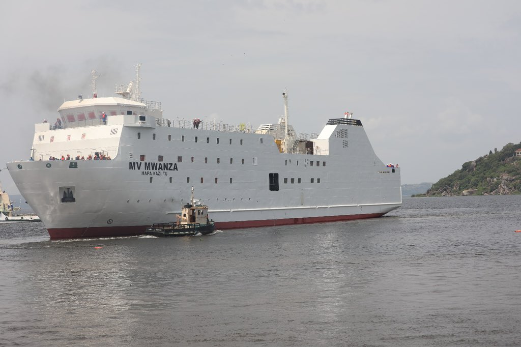
East Africa speaks confidently about the blue economy, regional integration, and Lake Victoria as a transport corridor. Governments talk about modern ferries, trade, tourism, ports, and safer movement. Yet beneath those ambitions lies a problem that should concern every maritime policymaker: the lake still lacks a comprehensive, continuously maintained hydrographic charting system.
This is not a new discovery. Some foundational surveys behind navigation charts date back to 1902–1906. A 2007 report on hydrographic work at Mwanza, Kisumu, and Port Bell described those areas as having last been surveyed during that period. The International Hydrographic Organization has also reported that UK Hydrographic Office charts for Lake Victoria are no longer updated because of inadequate information.
The Plans Exist. The Delivery Does Not.
The EAC and LVBC already know about it.
The LVBC Strategic Plan 2021–2026 specifically identifies hydrographic surveying and mapping of navigational routes on Lake Victoria as a strategic intervention. The EAC’s Sixth Development Strategy also set a target for hydrographic surveying and mapping of the lake’s navigational routes by 2026.
We are now in 2026.
So where is the modern hydrographic survey and where are the updated navigation products?
This is where the EAC and LVBC must move beyond plans and demonstrate delivery.
To be fair, important work has been undertaken. Surveys have covered approaches to major ports, including Kisumu, Mwanza, and Port Bell. Aids to navigation have been installed, and regional programmes have supported communications, weather information, and search-and-rescue capacity.
But they are not a substitute for comprehensive hydrography.
A buoy can mark a known hazard. It cannot discover every uncharted obstruction. A rescue boat can respond after an accident. It cannot prevent a vessel from grounding. GPS can tell a navigator where the vessel is; it cannot guarantee that the depth information beneath that position is accurate and current.
That is the central weakness of the present approach.
East Africa has invested in parts of the maritime safety system without demonstrating that underlying hydrographic information is systematically renewed, validated, published, and maintained.
A Chart Is Not a Historical Document
The lake is not static. Water levels change. Sedimentation changes depths and approaches. Shorelines and port facilities change. Navigation routes evolve. New passenger and cargo services increase traffic. Fishing activity changes patterns of movement. Climate variability can further complicate water-level conditions.
A navigation chart is therefore not a historical document. It is a living safety instrument.
The EAC and LVBC should treat hydrography as infrastructure—just like a port, ferry terminal, road, or bridge.
The solution does not require another declaration. It requires a regional Lake Victoria Hydrographic Renewal Programme with a clear timetable, budget, and public reporting.
Kenya, Uganda, and Tanzania should first establish a common inventory of existing surveys and bathymetric datasets. They should then identify high-risk routes and port approaches for immediate modern surveys, followed by systematic coverage of the wider lake.
The resulting data should be converted into official digital and paper navigational products, with regular corrections and Notices to Mariners. Modern IHO standards should guide the work. The region should develop a permanent mechanism through which ports, vessel operators, and surveyors can report changes and hazards.
Who Does What?
Responsibility must be clear.
Who surveys? Who pays? Who validates the data? Who produces the charts? Who updates them? Who issues navigational warnings? Who reports progress to the public?
These cannot remain unanswered questions.
The EAC provides the regional framework. LVBC exists to coordinate sustainable development and management of the Lake Victoria Basin. Their own strategic documents identify maritime safety and hydrographic surveying as priorities. The responsibility now is to turn those commitments into measurable results.
Lake Victoria cannot become a modern regional transport corridor if its navigational information remains trapped in the past. This is not an argument against the institutions. It is a demand that they match their ambitions with the safety infrastructure required to achieve them.
The Capacity Exists. The Coordination Does Not.
East Africa has the technology. It has trained surveyors, maritime authorities, universities, ports, and international partners. Modern hydrographic systems can produce detailed bathymetry and digital navigational information that earlier generations could never have imagined.
What is required now is coordination, financing, and political commitment. The region should stop asking whether Lake Victoria needs new charts. That question has already been answered.
The real question is why, after years of identifying the problem, a comprehensive and continuously maintained system has still not become an operational regional priority. Lake Victoria carries passengers, fishermen, traders, and modern vessels. Their safety should not depend on hydrographic knowledge inherited from the past.
A Test of Regional Seriousness
The EAC and LVBC have an opportunity in 2026 to change that. They should publish a clear roadmap, identify the responsible institutions, secure the financing, and begin the work.
The factual basis for sharper criticism is particularly strong. The EAC’s own 2022–2026 implementation matrix set hydrographic surveying and mapping of Lake Victoria as a target for 2026, while the LVBC strategic plan identifies the same activity and notes that earlier work covered only access ports, with resource mobilisation required for a survey of the entire lake. The IHO also confirms that UKHO Lake Victoria charts are no longer being updated because of inadequate information.
Lake Victoria does not need another promise.
It needs a chart that reflects the lake as it is today—and a system capable of keeping that chart accurate tomorrow.